Asset conditioning pipeline for IGNIS
IGNIS needs terrain and atmosphere that behave like the real world, not placeholder grids. POC Studio is the conditioning desk behind that: a CustomTkinter application that pulls elevation and OSM context, derives fuels and soils, computes fire-weather indices, and exports baked assets for the simulator. It is the workshop where Pocket Operations Commander’s maps and weather get made.
The studio
Condition the world before you command it
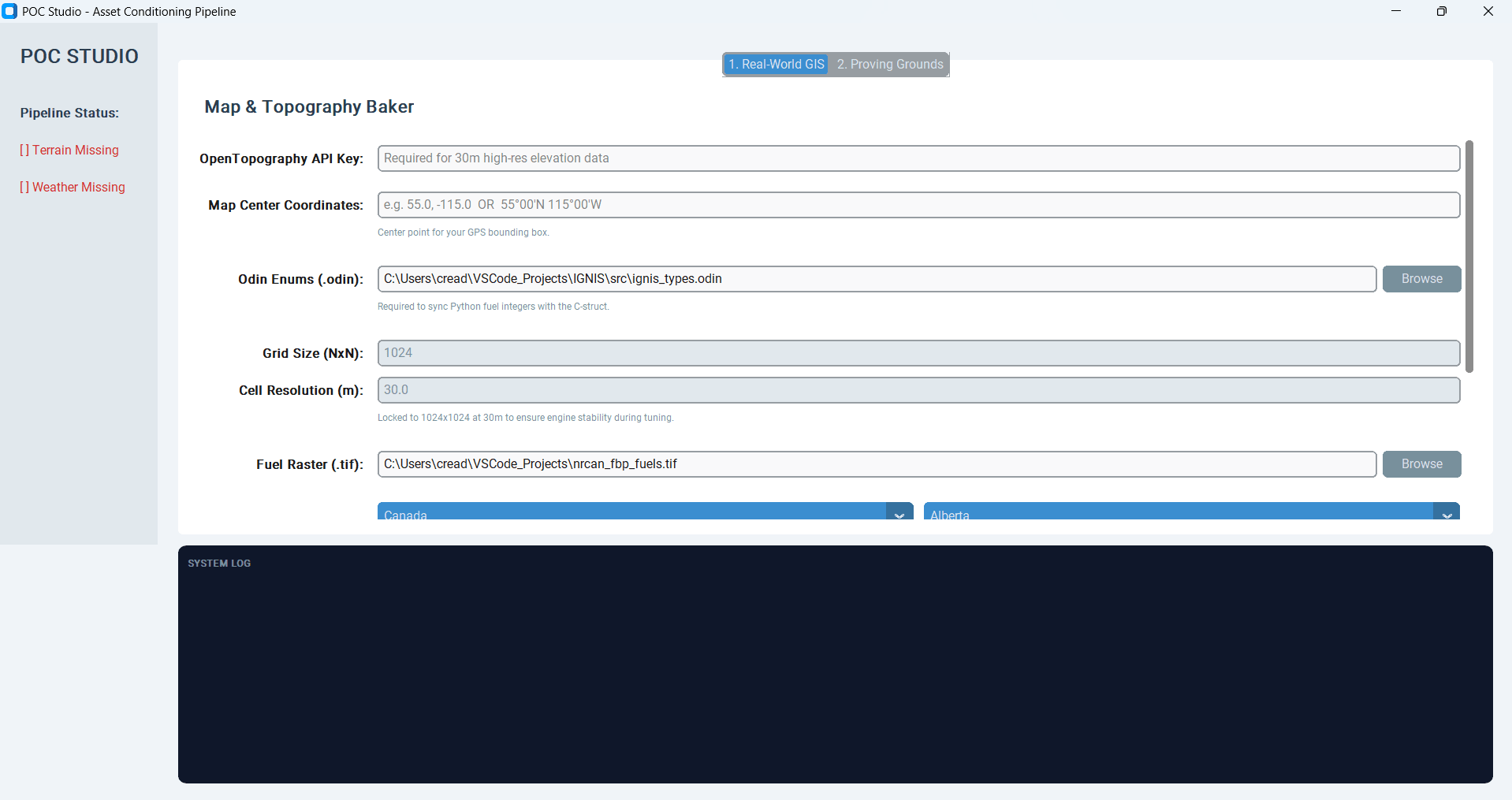
POC Studio opens as an Asset Conditioning Pipeline. Sidebar status tracks Terrain and Weather readiness. Real-World GIS is where coordinates, OpenTopography keys, NRCan fuel rasters, and IGNIS Odin enums meet — so Python fuel integers stay aligned with the simulator’s C-structs.
Pipeline · Map + Weather
One master execute for both assets
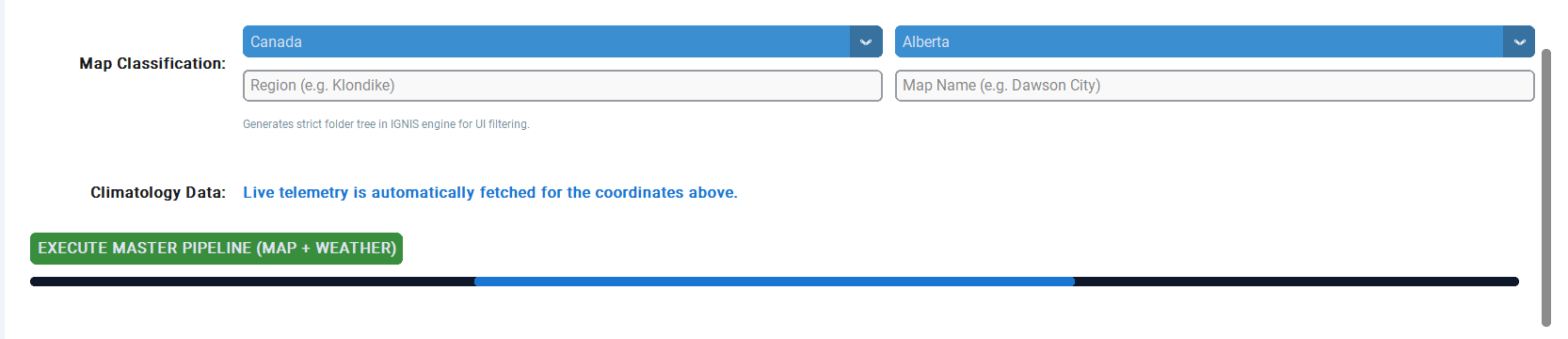
Region and map name generate a strict folder tree for IGNIS UI filtering. Climatology is fetched for the same coordinates. A single EXECUTE MASTER PIPELINE action runs map and weather conditioning together — with a progress bar and system log so background work stays visible.
Proving Grounds
Sterile terrain for engine tuning
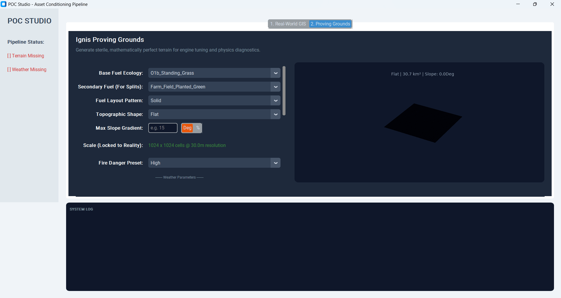
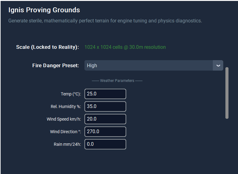
When you need physics diagnostics instead of the messy planet, Proving Grounds generates mathematically controlled terrain: fuel ecology, layout patterns, topographic shapes, slope units, and a locked 1024×1024 @ 30 m scale. A preview pane shows the sterile plane before bake.
Weather & FWI
Atmosphere as a first-class asset
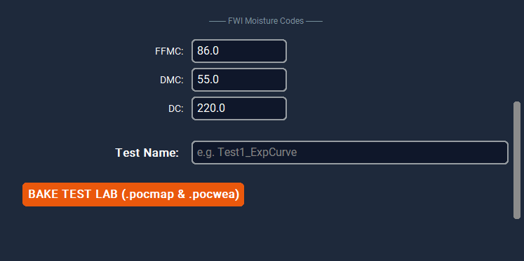
Fire danger presets and weather parameters — temperature, humidity, wind, rain — feed the lab. FWI moisture codes (FFMC, DMC, DC) sit beside a test name before BAKE TEST LAB writes `.pocmap` and `.pocwea` for IGNIS.
A simulator is only as honest as the world you feed it. POC Studio exists so IGNIS terrain and weather are conditioned deliberately — GIS in, baked assets out — instead of hand-waved placeholders.
Craft
Python studio, spatial math, explicit pipelines
Built with CustomTkinter for the desktop shell; NumPy, pandas, and Matplotlib for analysis; Rasterio, GeoPandas, OSMnx, and Shapely for spatial work; Requests for weather and elevation APIs. The code is organized as studio_app plus pipeline_map and pipeline_weather packages — clear seams for map baking and weather baking.
Problem
A wildfire simulator needs conditioned terrain and weather assets — not ad-hoc grids that drift from IGNIS fuel enums and fire-weather reality.
Approach
A desktop conditioning studio: GIS and weather pipelines that bake `.pocmap` and weather products aligned with IGNIS types.
Outcome
A working Python studio that turns coordinates and telemetry into simulator-ready assets — the backstage for Pocket Operations Commander.
Technologies
- Python
- CustomTkinter
- GIS
- NumPy
- GeoPandas
- Rasterio
- Fire Weather
- IGNIS